Geostore: AI-Powered Image Classification for Smarter Road Mapping
Services
AI Application, Web Application
Industry
Government
Client
Department of Budget and Management (DBM), Department of Agriculture (DOA), Commission on Audit (COA)
Challenge
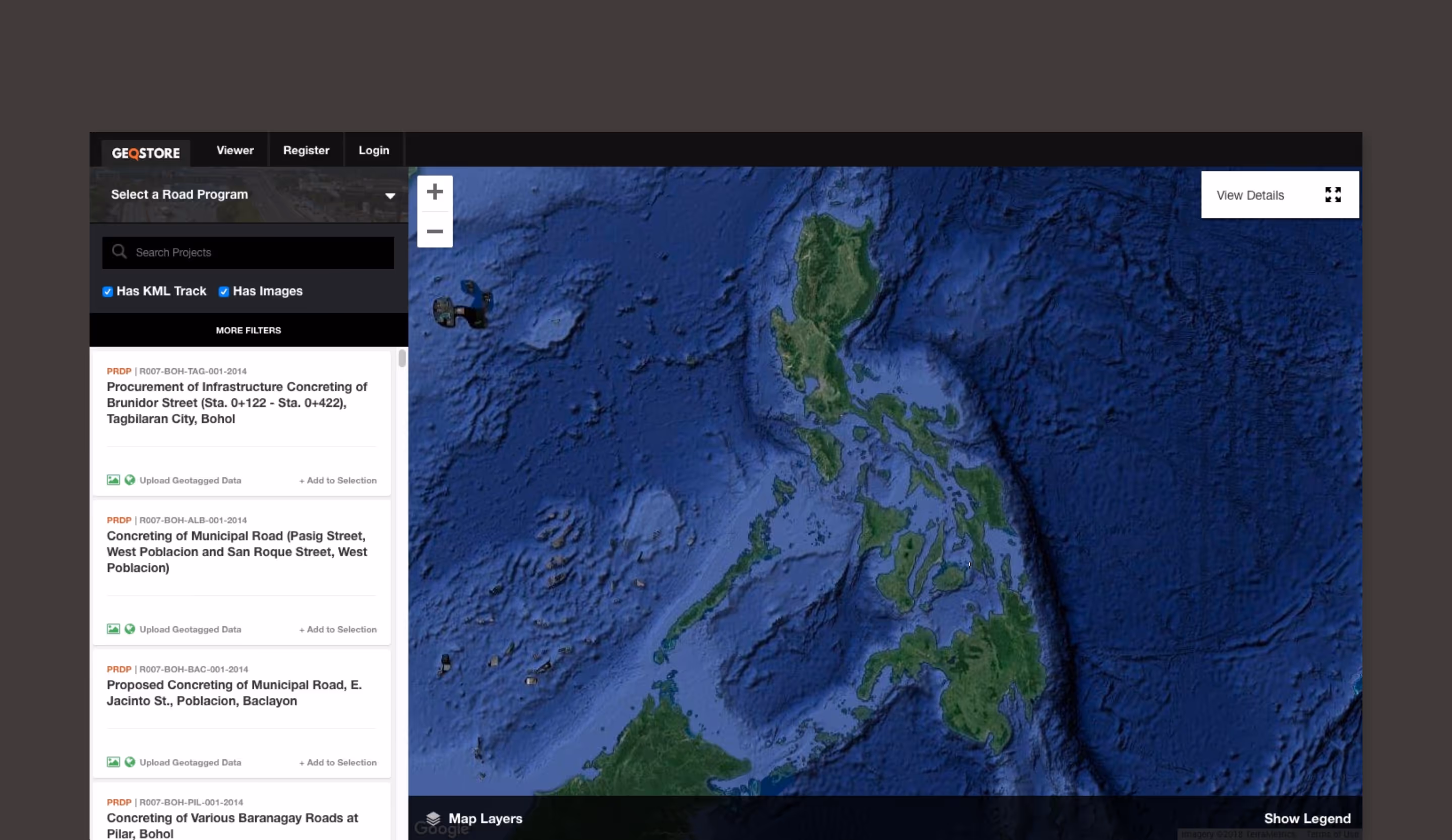
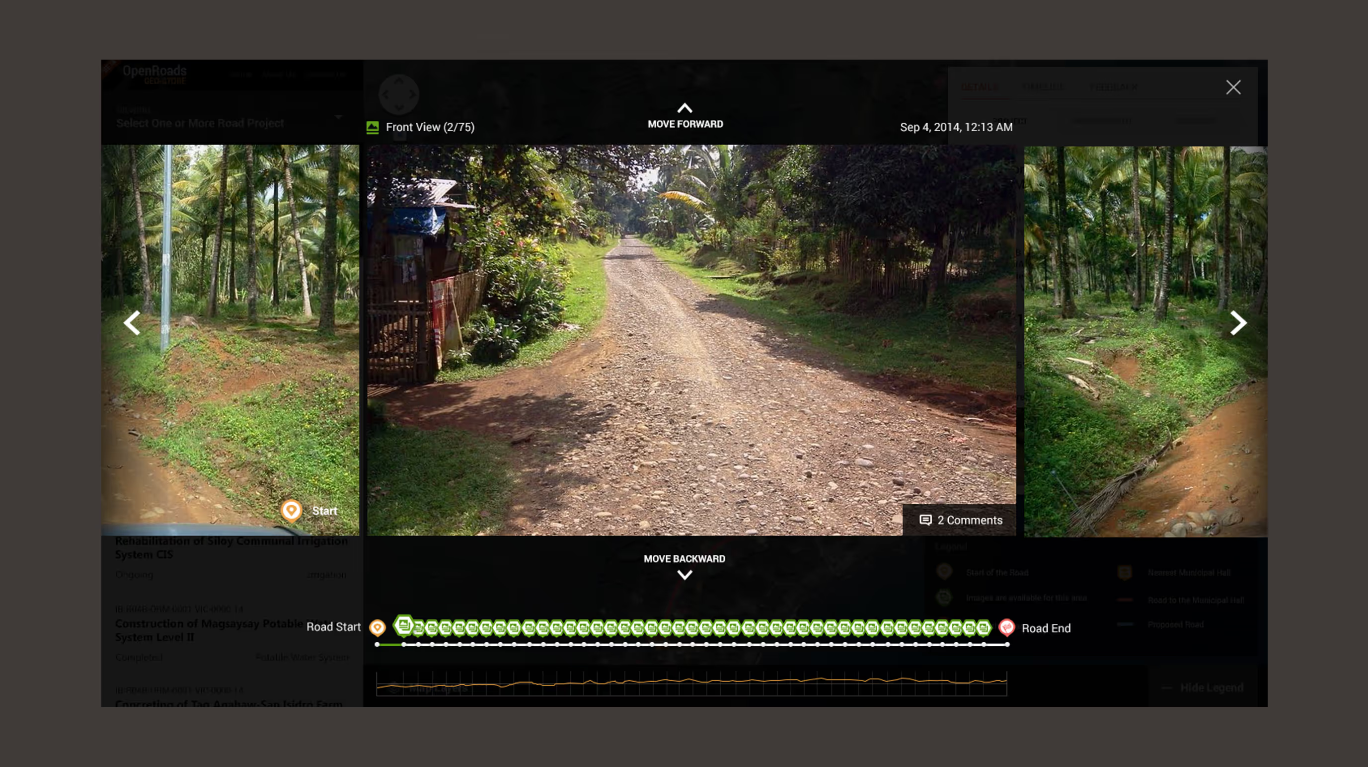
With over 200,000 road images collected nationwide, manual classification was time-consuming and inefficient. Decision-makers needed a faster, AI-driven approach to process and analyze road infrastructure data.
Solution
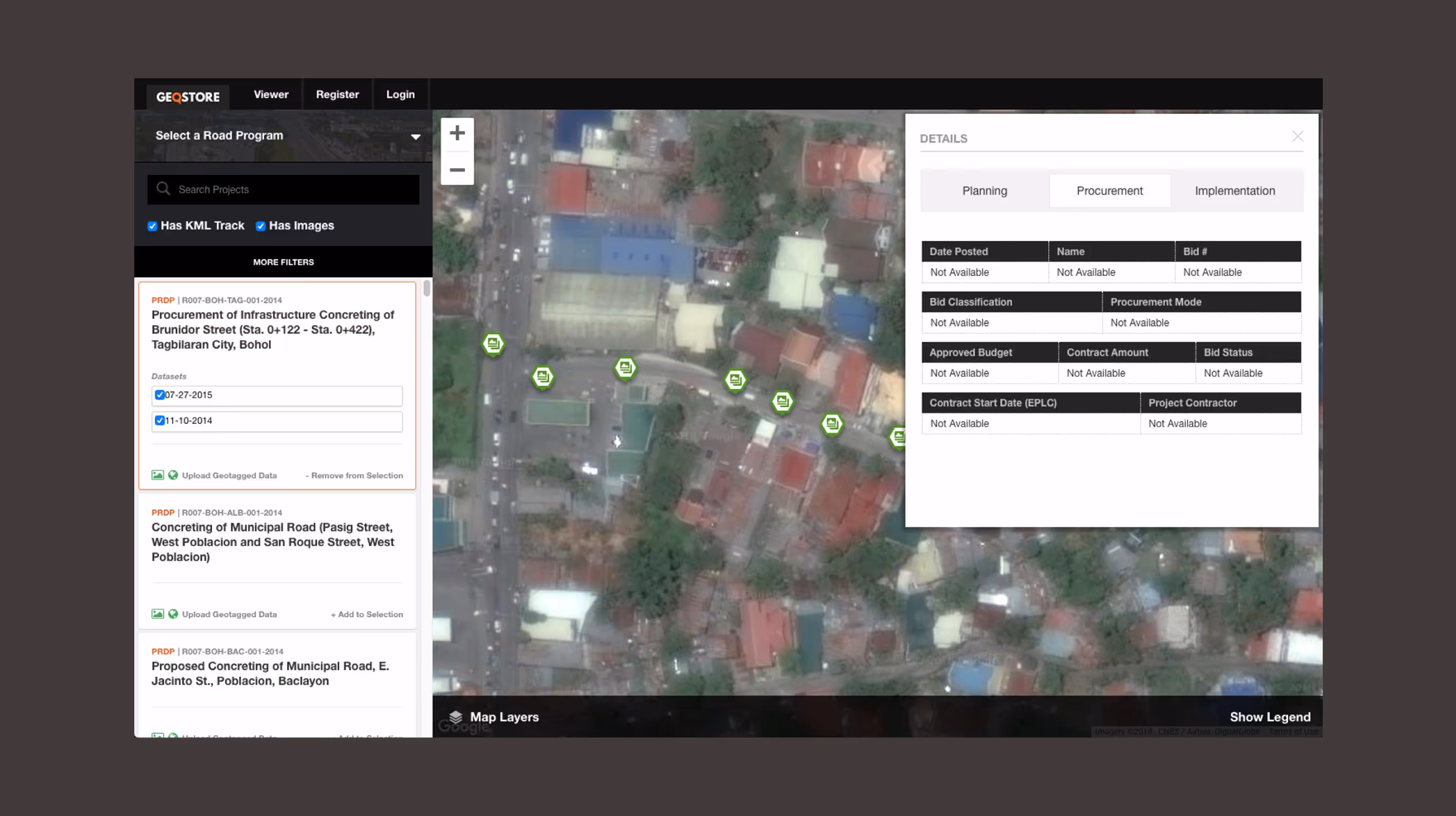
We built an AI-powered platform that automatically sorts and classifies road images, turning 200,000+ photos into structured, actionable data. Faster analysis, better accuracy, real decisions.
Impact
- Automated classification of 200,000+ road images
- Higher accuracy in road project analysis
- Data-driven insights for infrastructure planning

“For a complex web app, Symph really delivered what we had in mind from the beginning. We deeply appreciated their initiative to find ways to make the development process more efficient. We had a great collaboration with their team which resulted to an output that is currently serving its purpose for the Filipino people.”